Maps of the 18th century
13. Müller, Johann Christoph: Augustissimo Romanorum imperatori Iosepho I
regni Hungariae
Wien. 1709.

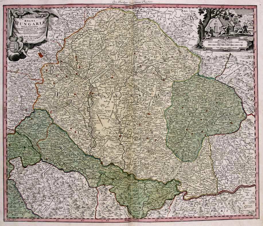
14. Homann, Johann Baptist: Regni Hungarie tabula generalis ex archetypo Mülleriano. Nürnberg. 1718.
15. lIsle, Guillaume de: Carte de la Hongrie, de la Transilvanie,
Paris-Haag. 1739.

16. Marsigli, Luigi Ferdinando: Mappa potamographica in qua fluvii
Le Haye. 1741.
17. Clouet, Jean Baptiste Louis: Royaume de Hongrie. Paris. 1767.

18. Müller, Ignaz: Mappa geographica novissima regni Hungariae
Vienna. 1769.

19. Milecz, Emericus: Mappa regni Hungariae
Poson. 1773.

20. Korabinszky János Mátyás: Novissima regni Hungariae potamographica et telluris
productorum tabula - Wasser und Producten Karte der Koenigreichs Ungarn - Magyarország természeti
tulajdonságának tüköre. Wien. 1791.

21. Townson, Robert: A new map of Hungary
London. 1797.

Back | Homepage