TÉRKÉPTÖRTÉNET
 |
Magyar
TÉRKÉPTÖRTÉNET |
|
| Virtuális térképtár/ Virtual Map Collection | ||
| Hungarian Map History | ||
| Térképek/ Maps | Kiállítás/ Exhibition | Térképgyűjtemények/ Map collections | ||
Régi
magyar térképek/ Old Maps of Hungary

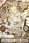
Lazarus 1528 Magyarország első nyomtatott országtérképe/The first known printed map of Hungary |

Angielini 1566 ? Kéziratos térkép részlete/ Part of a manuscript map |

Sambucus 1566 A Lázár-térkép bécsi kiadása/ The Vienna edition of Lazarus' map |

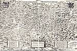
Honterus 1532 Az első Magyarországon nyomtatott térkép, az első országrész-térkép/ The first map printed in Hungary, and the first regional map of the country |

Lazius 1552-1556 Magyarország/ Hungary |

Schedel 1493 Látkép a Nürnbergi Krónikából/ View from the Nuremberg Chronicle |

Hevenesi ? 1696 A zsebatlasz szelvénye/ Sheet of the pocket atlas |

Honterus 1542 Kozmográfiai bevezető/ Introduction to cosmography |
Kiállítás/
Map exhibitions
Külföld/ International
- Országos Széchényi Könyvtár Térképtár/ Map Collection of the National Széchényi Library, Budapest
- ELTE Térképtudományi Tanszék/ Collection of the Department of Cartography, Budapest
- Hadtörténeti Intézet és Múzeum Térképtár/ Map Collection of the Hungarian Institute and Museum of Military History, Budapest
- Országos Levéltár/ State Archives, Budapest
- Főszékesegyházi Könyvtár/ Archiepiscopial Libray, Kalocsa
- Református Kollégium Könyvtára/ Library of the Reformed Church College, Debrecen
- Bencés Főkönyvtár/ Benedictine Library, Pannonhalma
- Duna Múzeum, Esztergom
Österreichische Nationalbibliothek, Wien, Austria
Österreichisches Staatsarchiv (Kriegsarchiv), Wien, Austria
Staatsbibliothek zu Berlin, Berlin, Germany
Bayerische Staatsbibliothek, München, Germany
Koninklijke Bibliotheek, Amsterdam, The Netherlands
Societa Geografica Italiana, Roma, Italy
Biblioteca Nazionale Marciana, Venezia, Italy
British Library, London, GB
Library of Congress, Washington D.C., USA
Harvard University, Cambridge, MA, USA